Mapping the age of American housing structures
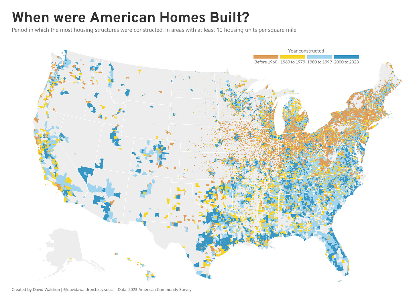
Here’s a map of when American housing structures were built.
Pre-1960 housing stock dominates the Northeast and parts of the Midwest, concentrated in what would become known as the Rust Belt. This aligns with these regions' early industrialization and urbanization.
More recent construction (1980-2023) is heavily concentrated in the Sun Belt, particularly in the Southeast. This tracks with significant population shifts toward these regions, driven by factors including lower cost of living and climate preferences.
The West presents a more fragmented pattern, with development largely confined to coastal areas and specific inland population centers, constrained by geography and water access. Still, areas of more recent construction appear in several mountain state metros as well as in the Pacific Northwest and California’s Central Valley.


